


berne

vincente204
User
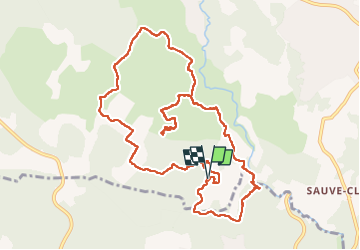

Length
13.3 km

Max alt
335 m

Uphill gradient
273 m
Km-Effort
16.9 km

Min alt
213 m

Downhill gradient
276 m
Boucle
Yes
Creation date :
2025-01-08 08:41:06.236
Updated on :
2025-01-14 13:17:51.463
5h50
Difficulty : Difficult

FREE GPS app for hiking
 SityTrail
IGN / Geographical institutes
SityTrail Plus
The world is yours!
About
Trail Walking of 13.3 km to be discovered at Provence-Alpes-Côte d'Azur, Var, Flayosc. This trail is proposed by vincente204.
Description
fácile
Positioning
Country:
France
Region :
Provence-Alpes-Côte d'Azur
Department/Province :
Var
Municipality :
Flayosc
Location:
Unknown
Start:(Dec)
Start:(UTM)
287008 ; 4821573 (32T) N.
Comments