


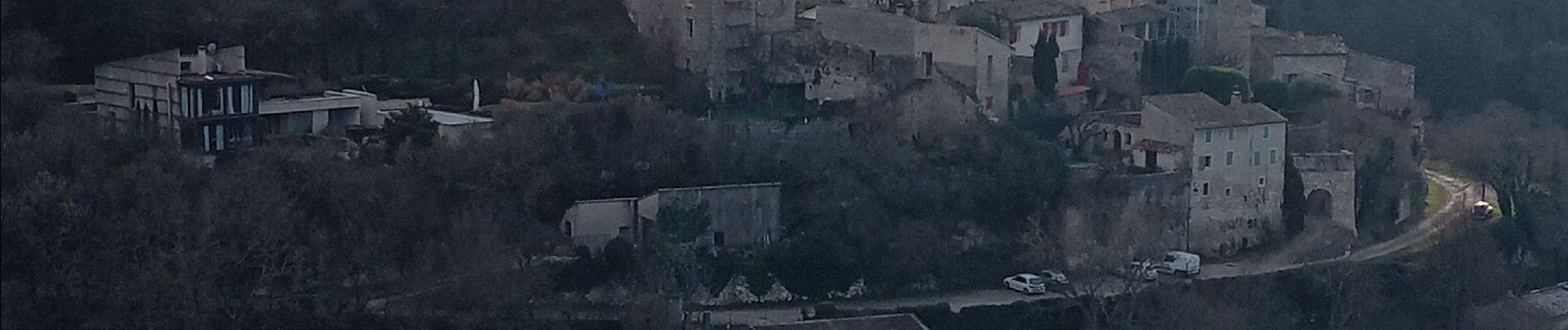
autour du Beaucet

FLORENSAC
User
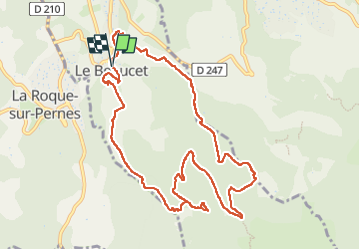

Length
12.2 km

Max alt
462 m

Uphill gradient
398 m
Km-Effort
17.5 km

Min alt
225 m

Downhill gradient
406 m
Boucle
Yes
Creation date :
2025-01-14 09:21:10.841
Updated on :
2025-01-14 15:07:43.454
5h46
Difficulty : Difficult

FREE GPS app for hiking
 SityTrail
IGN / Geographical institutes
SityTrail Plus
The world is yours!
About
Trail Walking of 12.2 km to be discovered at Provence-Alpes-Côte d'Azur, Vaucluse, Le Beaucet. This trail is proposed by FLORENSAC.
Description
tres belle rando , une jolie descente
avec ....Surprise regardez bien parterre
au niveau du jardin fait par des benevoles
Photos


Positioning
Country:
France
Region :
Provence-Alpes-Côte d'Azur
Department/Province :
Vaucluse
Municipality :
Le Beaucet
Location:
Unknown
Start:(Dec)
Start:(UTM)
669949 ; 4872212 (31T) N.
Comments