


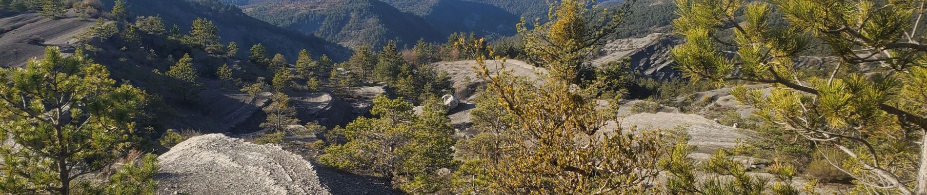
Villar des dourbes archail 734m 12kms

Danielba
User GUIDE
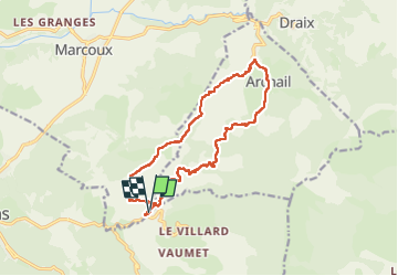

Length
15.8 km

Max alt
1112 m

Uphill gradient
570 m
Km-Effort
23 km

Min alt
749 m

Downhill gradient
574 m
Boucle
Yes
Creation date :
2025-01-14 07:47:37.243
Updated on :
2025-01-14 17:53:06.8
7h10
Difficulty : Easy

FREE GPS app for hiking
 SityTrail
IGN / Geographical institutes
SityTrail Plus
The world is yours!
About
Trail Walking of 15.8 km to be discovered at Provence-Alpes-Côte d'Azur, Alpes-de-Haute-Provence, Marcoux. This trail is proposed by Danielba .
Photos


Positioning
Country:
France
Region :
Provence-Alpes-Côte d'Azur
Department/Province :
Alpes-de-Haute-Provence
Municipality :
Marcoux
Location:
Unknown
Start:(Dec)
Start:(UTM)
283641 ; 4885662 (32T) N.
Comments