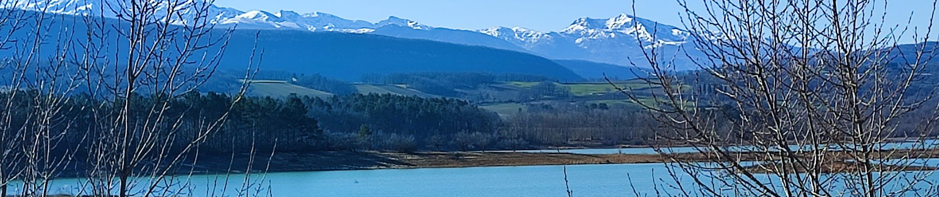
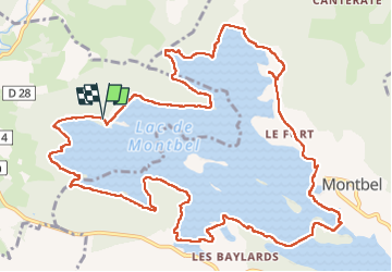
Trail Walking Léran - tour lac Montbel  - Photo

tour lac Montbel

© OpenStreetMap contributors
Length
Length
16.6 km
Max alt
Max alt
422 m
Uphill gradient
Uphill gradient
199 m
Km-Effort
Km-Effort  
19.2 km
Min alt
Min alt
394 m
Downhill gradient
Downhill gradient
201 m
Boucle
Boucle
Yes
Creation date :
2025-01-14 08:53:13.233
Updated on :
2025-01-23 08:37:59.773

(0 Reviews)

Walking
Walking
4h19
Difficulty : Medium

Scan this QR Code to open this trail in the SityTrail application

FREE GPS app for hiking

Logo SityTrail SityTrail

IGN / Geographical institutes

Download SityTrail from the App Store Download SityTrail from Google Play

Logo SityTrail SityTrail Plus

The world is yours!

Download SityTrail from the App Store Download SityTrail from Google Play Download SityTrail on Huawei AppGallery

About

Trail Walking of 16.6 km to be discovered at Occitania, Ariège, Léran. This trail is proposed by Mamilaure.

Description

Se garer au parking de la base de loisirs de Leran près du camping pour une belle rando
Pose Déjeuner possible à la plage Montbel où il y a des tables
Attention prendre de bonnes chaussures et bâtons car passages boueux peuvent être glissants

Elevation profile

Photos

Positioning

Country:
France
Region :
Occitania
Department/Province :
Ariège
Municipality :
Léran
Location:
Unknown
Start:(UTM)
413396 ; 4759511 (31T) N.


Close
My subscriptions