


siou_blanc_clos_de_peiron_aig_valb_by_eric_g-20382841-1736967173-137

Eric Go
User
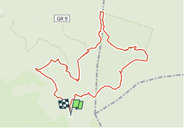

Length
12.3 km

Max alt
720 m

Uphill gradient
370 m
Km-Effort
17.2 km

Min alt
388 m

Downhill gradient
371 m
Boucle
Yes
Creation date :
2025-01-15 18:56:17.719
Updated on :
2025-03-19 21:06:09.706
3h54
Difficulty : Difficult

FREE GPS app for hiking
 SityTrail
IGN / Geographical institutes
SityTrail Plus
The world is yours!
About
Trail Walking of 12.3 km to be discovered at Provence-Alpes-Côte d'Azur, Var, Signes. This trail is proposed by Eric Go.


Positioning
Country:
France
Region :
Provence-Alpes-Côte d'Azur
Department/Province :
Var
Municipality :
Signes
Location:
Unknown
Start:(Dec)
Start:(UTM)
737212 ; 4790516 (31T) N.
Comments