


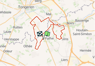
Wihogne 30 km

Alain Williaume
User

Length
30 km

Max alt
153 m

Uphill gradient
266 m
Km-Effort
33 km

Min alt
73 m

Downhill gradient
266 m
Boucle
Yes
Creation date :
2025-01-19 06:47:40.0
Updated on :
2025-01-19 12:20:02.724
5h31
Difficulty : Easy

FREE GPS app for hiking
 SityTrail
IGN / Geographical institutes
SityTrail Plus
The world is yours!
About
Trail Walking of 30 km to be discovered at Wallonia, Liège, Juprelle. This trail is proposed by Alain Williaume.
Positioning
Country:
Belgium
Region :
Wallonia
Department/Province :
Liège
Municipality :
Juprelle
Location:
Unknown
Start:(Dec)
Start:(UTM)
677104 ; 5622408 (31U) N.
Comments