


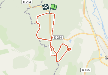
Cascade de la Tuffiere

pmg.griot
User

Length
8.5 km

Max alt
426 m

Uphill gradient
136 m
Km-Effort
10.3 km

Min alt
341 m

Downhill gradient
137 m
Boucle
Yes
Creation date :
2025-01-20 09:34:58.65
Updated on :
2025-01-24 13:19:32.001
2h30
Difficulty : Easy

FREE GPS app for hiking
 SityTrail
IGN / Geographical institutes
SityTrail Plus
The world is yours!
About
Trail Walking of 8.5 km to be discovered at Grand Est, Haute-Marne, Rolampont. This trail is proposed by pmg.griot.
Positioning
Country:
France
Region :
Grand Est
Department/Province :
Haute-Marne
Municipality :
Rolampont
Location:
Unknown
Start:(Dec)
Start:(UTM)
667847 ; 5315023 (31T) N.
Comments