


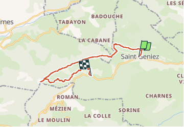
Montagne de Gache (Saint-Geniez 04)

Clo0413
User

Length
12.6 km

Max alt
1336 m

Uphill gradient
533 m
Km-Effort
20 km

Min alt
1032 m

Downhill gradient
616 m
Boucle
No
Creation date :
2025-01-20 09:00:21.566
Updated on :
2025-01-21 08:31:16.936
4h33
Difficulty : Medium

FREE GPS app for hiking
 SityTrail
IGN / Geographical institutes
SityTrail Plus
The world is yours!
About
Trail Walking of 12.6 km to be discovered at Provence-Alpes-Côte d'Azur, Alpes-de-Haute-Provence, Saint-Geniez. This trail is proposed by Clo0413.
Positioning
Country:
France
Region :
Provence-Alpes-Côte d'Azur
Department/Province :
Alpes-de-Haute-Provence
Municipality :
Saint-Geniez
Location:
Unknown
Start:(Dec)
Start:(UTM)
264602 ; 4903305 (32T) N.
Comments