


Digne givaudan 900m 16kms

Danielba
User GUIDE
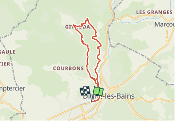

Length
15.7 km

Max alt
1002 m

Uphill gradient
797 m
Km-Effort
26 km

Min alt
592 m

Downhill gradient
797 m
Boucle
Yes
Creation date :
2025-01-21 07:36:26.324
Updated on :
2025-01-21 16:18:10.246
7h04
Difficulty : Easy

FREE GPS app for hiking
 SityTrail
IGN / Geographical institutes
SityTrail Plus
The world is yours!
About
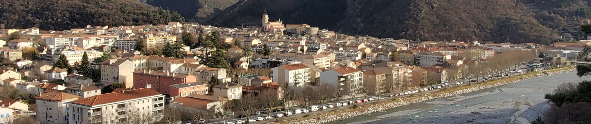
Trail Walking of 15.7 km to be discovered at Provence-Alpes-Côte d'Azur, Alpes-de-Haute-Provence, Digne-les-Bains. This trail is proposed by Danielba .
Photos


Positioning
Country:
France
Region :
Provence-Alpes-Côte d'Azur
Department/Province :
Alpes-de-Haute-Provence
Municipality :
Digne-les-Bains
Location:
Unknown
Start:(Dec)
Start:(UTM)
277693 ; 4885462 (32T) N.
Comments