


Roybon la chapelle en Vercors

taguette
User
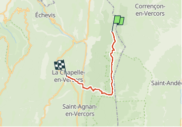

Length
15.9 km

Max alt
1423 m

Uphill gradient
393 m
Km-Effort
23 km

Min alt
750 m

Downhill gradient
826 m
Boucle
No
Creation date :
2025-01-21 08:17:41.753
Updated on :
2025-01-21 17:33:40.743
9h14
Difficulty : Very difficult

FREE GPS app for hiking
 SityTrail
IGN / Geographical institutes
SityTrail Plus
The world is yours!
About
Trail Walking of 15.9 km to be discovered at Auvergne-Rhône-Alpes, Drôme, Saint-Martin-en-Vercors. This trail is proposed by taguette.
Positioning
Country:
France
Region :
Auvergne-Rhône-Alpes
Department/Province :
Drôme
Municipality :
Saint-Martin-en-Vercors
Location:
Unknown
Start:(Dec)
Start:(UTM)
695070 ; 4987099 (31T) N.
Comments