


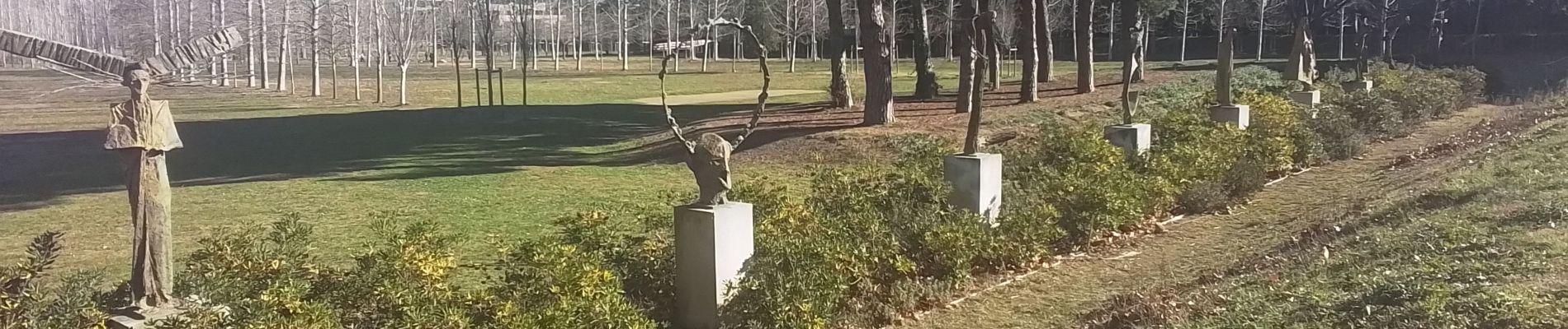
Antigone-parc Charpac

JEANJOSY
User
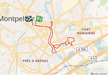

Length
8.4 km

Max alt
29 m

Uphill gradient
80 m
Km-Effort
9.4 km

Min alt
5 m

Downhill gradient
78 m
Boucle
Yes
Creation date :
2025-01-23 12:21:16.702
Updated on :
2025-01-23 16:20:46.801
2h01
Difficulty : Very easy

FREE GPS app for hiking
 SityTrail
IGN / Geographical institutes
SityTrail Plus
The world is yours!
About
Trail Walking of 8.4 km to be discovered at Occitania, Hérault, Montpellier. This trail is proposed by JEANJOSY.
Description
un bol d’air à Montpellier
Photos


Positioning
Country:
France
Region :
Occitania
Department/Province :
Hérault
Municipality :
Montpellier
Location:
Unknown
Start:(Dec)
Start:(UTM)
571643 ; 4828744 (31T) N.
Comments