


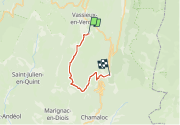
Vassieux en Vercors Col Rousser

taguette
User

Length
16 km

Max alt
1544 m

Uphill gradient
785 m
Km-Effort
26 km

Min alt
1084 m

Downhill gradient
611 m
Boucle
No
Creation date :
2025-01-23 08:29:24.014
Updated on :
2025-01-23 16:57:10.502
8h27
Difficulty : Very difficult

FREE GPS app for hiking
 SityTrail
IGN / Geographical institutes
SityTrail Plus
The world is yours!
About
Trail Walking of 16 km to be discovered at Auvergne-Rhône-Alpes, Drôme, Vassieux-en-Vercors. This trail is proposed by taguette.
Positioning
Country:
France
Region :
Auvergne-Rhône-Alpes
Department/Province :
Drôme
Municipality :
Vassieux-en-Vercors
Location:
Unknown
Start:(Dec)
Start:(UTM)
687679 ; 4972452 (31T) N.
Comments