


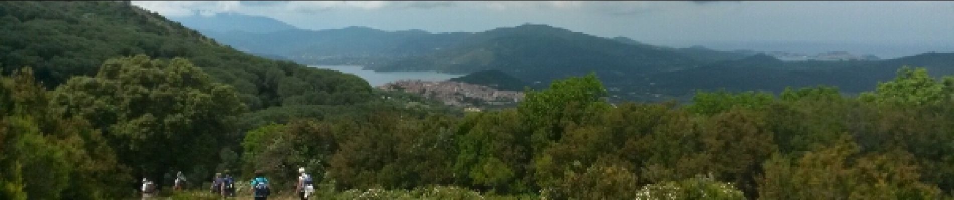
elbe calamita capoliveri

jnpollet
User
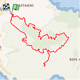

Length
13.6 km

Max alt
394 m

Uphill gradient
402 m
Km-Effort
18.9 km

Min alt
192 m

Downhill gradient
404 m
Boucle
Yes
Creation date :
2015-06-12 00:00:00.0
Updated on :
2015-06-12 00:00:00.0
4h55
Difficulty : Unknown

FREE GPS app for hiking
 SityTrail
IGN / Geographical institutes
SityTrail Plus
The world is yours!
About
Trail Other activity of 13.6 km to be discovered at Tuscany, Livorno, Capoliveri. This trail is proposed by jnpollet.
Description
elbe
Photos


Positioning
Country:
Italy
Region :
Tuscany
Department/Province :
Livorno
Municipality :
Capoliveri
Location:
Unknown
Start:(Dec)
Start:(UTM)
613406 ; 4733044 (32T) N.
Comments