


lure

PatriceCocuaud
User
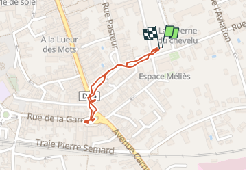

Length
690 m

Max alt
294 m

Uphill gradient
3 m
Km-Effort
730 m

Min alt
291 m

Downhill gradient
3 m
Boucle
Yes
Creation date :
2025-01-24 10:46:25.669
Updated on :
2025-01-24 15:13:06.472
22m
Difficulty : Very easy

FREE GPS app for hiking
 SityTrail
IGN / Geographical institutes
SityTrail Plus
The world is yours!
About
Trail Walking of 690 m to be discovered at Bourgogne-Franche-Comté, Haute-Saône, Lure. This trail is proposed by PatriceCocuaud.
Positioning
Country:
France
Region :
Bourgogne-Franche-Comté
Department/Province :
Haute-Saône
Municipality :
Lure
Location:
Unknown
Start:(Dec)
Start:(UTM)
312257 ; 5284318 (32T) N.
Comments