


ADEPS Alan et

Airelle
User
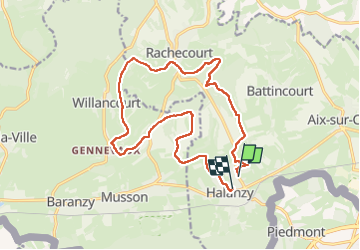

Length
15.7 km

Max alt
351 m

Uphill gradient
301 m
Km-Effort
19.8 km

Min alt
243 m

Downhill gradient
314 m
Boucle
No
Creation date :
2025-01-26 09:04:54.0
Updated on :
2025-01-26 12:43:42.593

FREE GPS app for hiking
 SityTrail
IGN / Geographical institutes
SityTrail Plus
The world is yours!
About
Trail of 15.7 km to be discovered at Wallonia, Luxembourg, Aubange. This trail is proposed by Airelle.
Positioning
Country:
Belgium
Region :
Wallonia
Department/Province :
Luxembourg
Municipality :
Aubange
Location:
Unknown
Start:(Dec)
Start:(UTM)
698511 ; 5493627 (31U) N.
Comments