


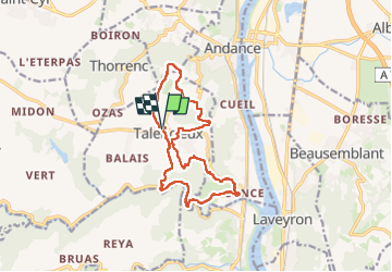
talencieux

cousam
User

Length
14.2 km

Max alt
398 m

Uphill gradient
434 m
Km-Effort
20 km

Min alt
152 m

Downhill gradient
434 m
Boucle
Yes
Creation date :
2025-01-26 07:04:52.142
Updated on :
2025-01-26 14:50:01.517
4h07
Difficulty : Easy

FREE GPS app for hiking
 SityTrail
IGN / Geographical institutes
SityTrail Plus
The world is yours!
About
Trail Walking of 14.2 km to be discovered at Auvergne-Rhône-Alpes, Ardèche, Talencieux. This trail is proposed by cousam.
Photos


Positioning
Country:
France
Region :
Auvergne-Rhône-Alpes
Department/Province :
Ardèche
Municipality :
Talencieux
Location:
Unknown
Start:(Dec)
Start:(UTM)
639493 ; 5009206 (31T) N.
Comments