


la-scia-depuis-le-planolet

Mariolebeno
User
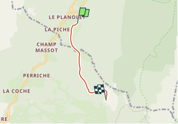

Length
2.8 km

Max alt
1786 m

Uphill gradient
668 m
Km-Effort
9.5 km

Min alt
1114 m

Downhill gradient
0 m
Boucle
No
Creation date :
2025-01-28 14:30:08.947
Updated on :
2025-01-30 08:40:43.103
2h30
Difficulty : Easy

FREE GPS app for hiking
 SityTrail
IGN / Geographical institutes
SityTrail Plus
The world is yours!
About
Trail Touring skiing of 2.8 km to be discovered at Auvergne-Rhône-Alpes, Isère, Saint-Pierre-d'Entremont. This trail is proposed by Mariolebeno.
Positioning
Country:
France
Region :
Auvergne-Rhône-Alpes
Department/Province :
Isère
Municipality :
Saint-Pierre-d'Entremont
Location:
Unknown
Start:(Dec)
Start:(UTM)
722456 ; 5027726 (31T) N.
Comments