


Moussoujens Jlc001

jl_chocho
User
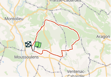

Length
13.6 km

Max alt
298 m

Uphill gradient
199 m
Km-Effort
16.3 km

Min alt
156 m

Downhill gradient
197 m
Boucle
Yes
Creation date :
2025-01-28 12:08:06.0
Updated on :
2025-01-28 15:19:02.495
2h52
Difficulty : Difficult

FREE GPS app for hiking
 SityTrail
IGN / Geographical institutes
SityTrail Plus
The world is yours!
About
Trail Walking of 13.6 km to be discovered at Occitania, Aude, Moussoulens. This trail is proposed by jl_chocho.
Positioning
Country:
France
Region :
Occitania
Department/Province :
Aude
Municipality :
Moussoulens
Location:
Unknown
Start:(Dec)
Start:(UTM)
438070 ; 4792590 (31T) N.
Comments