


trace

Mariolebeno
User
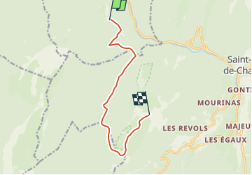

Length
9.4 km

Max alt
1857 m

Uphill gradient
1177 m
Km-Effort
22 km

Min alt
857 m

Downhill gradient
200 m
Boucle
No
Creation date :
2025-01-29 09:50:11.523
Updated on :
2025-01-29 10:02:13.384
4h00
Difficulty : Medium

FREE GPS app for hiking
 SityTrail
IGN / Geographical institutes
SityTrail Plus
The world is yours!
About
Trail Touring skiing of 9.4 km to be discovered at Auvergne-Rhône-Alpes, Isère, Saint-Laurent-du-Pont. This trail is proposed by Mariolebeno.
Positioning
Country:
France
Region :
Auvergne-Rhône-Alpes
Department/Province :
Isère
Municipality :
Saint-Laurent-du-Pont
Location:
Unknown
Start:(Dec)
Start:(UTM)
714941 ; 5026388 (31T) N.
Comments