


2015-01-30T17:34:02Z

Mariolebeno
User
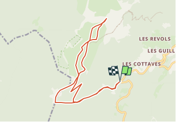

Length
10 km

Max alt
1857 m

Uphill gradient
835 m
Km-Effort
21 km

Min alt
1130 m

Downhill gradient
837 m
Boucle
Yes
Creation date :
2025-01-29 10:05:16.824
Updated on :
2025-01-30 10:01:57.121
3h00
Difficulty : Easy

FREE GPS app for hiking
 SityTrail
IGN / Geographical institutes
SityTrail Plus
The world is yours!
About
Trail Touring skiing of 10 km to be discovered at Auvergne-Rhône-Alpes, Isère, Saint-Pierre-de-Chartreuse. This trail is proposed by Mariolebeno.
Positioning
Country:
France
Region :
Auvergne-Rhône-Alpes
Department/Province :
Isère
Municipality :
Saint-Pierre-de-Chartreuse
Location:
Unknown
Start:(Dec)
Start:(UTM)
717067 ; 5021078 (31T) N.
Comments