


Ski

jouans
User GUIDE
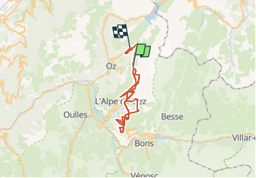

Length
48 km

Max alt
2806 m

Uphill gradient
4369 m
Km-Effort
108 km

Min alt
1199 m

Downhill gradient
5063 m
Boucle
No
Creation date :
2025-01-29 08:46:27.0
Updated on :
2025-01-29 12:17:47.237

FREE GPS app for hiking
 SityTrail
IGN / Geographical institutes
SityTrail Plus
The world is yours!
About
Trail of 48 km to be discovered at Auvergne-Rhône-Alpes, Isère, Oz. This trail is proposed by jouans.
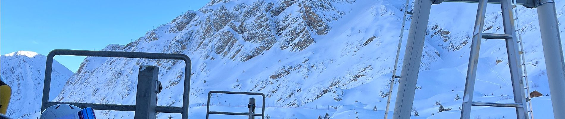
Photos


Positioning
Country:
France
Region :
Auvergne-Rhône-Alpes
Department/Province :
Isère
Municipality :
Oz
Location:
Unknown
Start:(Dec)
Start:(UTM)
271504 ; 5002517 (32T) N.
Comments