


Causse du Masseguin 575 +

claude nier
User
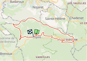

Length
20 km

Max alt
1205 m

Uphill gradient
575 m
Km-Effort
28 km

Min alt
818 m

Downhill gradient
572 m
Boucle
Yes
Creation date :
2025-01-29 16:58:49.759
Updated on :
2025-01-29 17:00:01.655
6h20
Difficulty : Very difficult

FREE GPS app for hiking
 SityTrail
IGN / Geographical institutes
SityTrail Plus
The world is yours!
About
Trail Walking of 20 km to be discovered at Occitania, Lozère, Lanuéjols. This trail is proposed by claude nier.
Description
Depart Lanuejols
Positioning
Country:
France
Region :
Occitania
Department/Province :
Lozère
Municipality :
Lanuéjols
Location:
Unknown
Start:(Dec)
Start:(UTM)
545440 ; 4927588 (31T) N.
Comments