


Source du Lot 871 +

claude nier
User

Length
26 km

Max alt
1364 m

Uphill gradient
871 m
Km-Effort
38 km

Min alt
866 m

Downhill gradient
860 m
Boucle
Yes
Creation date :
2025-01-29 17:16:49.946
Updated on :
2025-01-29 17:17:40.886
8h36
Difficulty : Very difficult

FREE GPS app for hiking
 SityTrail
IGN / Geographical institutes
SityTrail Plus
The world is yours!
About
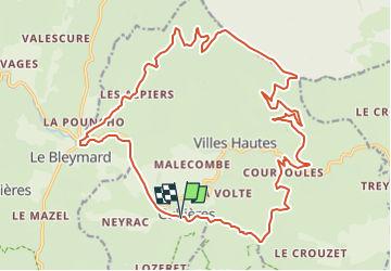
Trail Walking of 26 km to be discovered at Occitania, Lozère, Cubières. This trail is proposed by claude nier.
Description
DepartCubieres
Positioning
Country:
France
Region :
Occitania
Department/Province :
Lozère
Municipality :
Cubières
Location:
Unknown
Start:(Dec)
Start:(UTM)
561326 ; 4924688 (31T) N.
Comments