


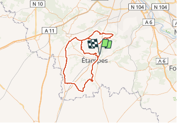
2015-06-15-Morigny Champigny 105km

Lucquiaud
User

Length
104 km

Max alt
162 m

Uphill gradient
918 m
Km-Effort
116 km

Min alt
62 m

Downhill gradient
917 m
Boucle
Yes
Creation date :
2018-09-15 15:06:11.548
Updated on :
2018-09-15 15:06:12.082
4h48
Difficulty : Easy

FREE GPS app for hiking
 SityTrail
IGN / Geographical institutes
SityTrail Plus
The world is yours!
About
Trail Cycle of 104 km to be discovered at Ile-de-France, Essonne, Morigny-Champigny. This trail is proposed by Lucquiaud.
Positioning
Country:
France
Region :
Ile-de-France
Department/Province :
Essonne
Municipality :
Morigny-Champigny
Location:
Unknown
Start:(Dec)
Start:(UTM)
440219 ; 5367030 (31U) N.
Comments