


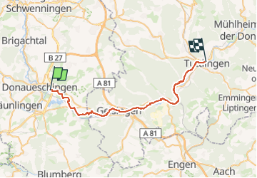
10'' - Donaueschingen - Tuttlingen

v.hanosset
User

Length
34 km

Max alt
685 m

Uphill gradient
252 m
Km-Effort
37 km

Min alt
640 m

Downhill gradient
281 m
Boucle
No
Creation date :
2025-01-31 09:57:02.229
Updated on :
2025-01-31 10:38:53.86
2h16
Difficulty : Difficult

FREE GPS app for hiking
 SityTrail
IGN / Geographical institutes
SityTrail Plus
The world is yours!
About
Trail Road bike of 34 km to be discovered at Baden-Württemberg, Schwarzwald-Baar-Kreis, Donaueschingen. This trail is proposed by v.hanosset.
Positioning
Country:
Germany
Region :
Baden-Württemberg
Department/Province :
Schwarzwald-Baar-Kreis
Municipality :
Donaueschingen
Location:
Unknown
Start:(Dec)
Start:(UTM)
464033 ; 5310764 (32T) N.
Comments