


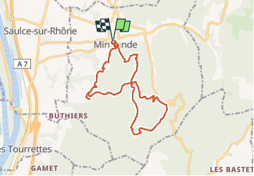
Mirmande hameau de Platet Col des Mure Crêtes de mallivert col de Papillères

Danielle07
User

Length
16.9 km

Max alt
574 m

Uphill gradient
675 m
Km-Effort
26 km

Min alt
181 m

Downhill gradient
676 m
Boucle
Yes
Creation date :
2025-01-31 08:35:06.259
Updated on :
2025-01-31 17:11:51.926
5h53
Difficulty : Medium

FREE GPS app for hiking
 SityTrail
IGN / Geographical institutes
SityTrail Plus
The world is yours!
About
Trail Walking of 16.9 km to be discovered at Auvergne-Rhône-Alpes, Drôme, Mirmande. This trail is proposed by Danielle07.
Description
Trés beau village de Mirmande, hameau de platet et ses outils anciens exposés
Positioning
Country:
France
Region :
Auvergne-Rhône-Alpes
Department/Province :
Drôme
Municipality :
Mirmande
Location:
Unknown
Start:(Dec)
Start:(UTM)
645370 ; 4951192 (31T) N.
Comments