


Chapelle Saint-Simon (Molines La Rua 05) raquettes

Clo0413
User
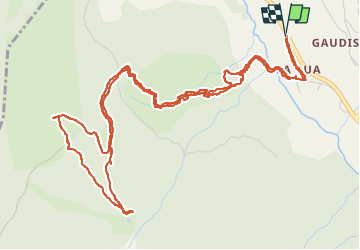

Length
8.3 km

Max alt
2205 m

Uphill gradient
577 m
Km-Effort
16 km

Min alt
1671 m

Downhill gradient
576 m
Boucle
Yes
Creation date :
2025-02-02 08:42:13.385
Updated on :
2025-02-03 07:09:20.177
2h48
Difficulty : Medium

FREE GPS app for hiking
 SityTrail
IGN / Geographical institutes
SityTrail Plus
The world is yours!
About
Trail Walking of 8.3 km to be discovered at Provence-Alpes-Côte d'Azur, Hautes-Alpes, Molines-en-Queyras. This trail is proposed by Clo0413.
Positioning
Country:
France
Region :
Provence-Alpes-Côte d'Azur
Department/Province :
Hautes-Alpes
Municipality :
Molines-en-Queyras
Location:
Unknown
Start:(Dec)
Start:(UTM)
328525 ; 4955915 (32T) N.
Comments