


Saint Zacharie Naïes 23 janvier 2025

rlebasque
User
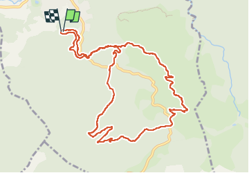

Length
12.8 km

Max alt
556 m

Uphill gradient
467 m
Km-Effort
19 km

Min alt
274 m

Downhill gradient
468 m
Boucle
Yes
Creation date :
2025-01-23 08:07:18.744
Updated on :
2025-02-03 22:17:38.093
5h18
Difficulty : Very difficult

FREE GPS app for hiking
 SityTrail
IGN / Geographical institutes
SityTrail Plus
The world is yours!
About
Trail Walking of 12.8 km to be discovered at Provence-Alpes-Côte d'Azur, Var, Saint-Zacharie. This trail is proposed by rlebasque.
Positioning
Country:
France
Region :
Provence-Alpes-Côte d'Azur
Department/Province :
Var
Municipality :
Saint-Zacharie
Location:
Unknown
Start:(Dec)
Start:(UTM)
719413 ; 4805935 (31T) N.
Comments