


Mini séjour Gavarnie

Franpey
User

Length
41 km

Max alt
2823 m

Uphill gradient
3296 m
Km-Effort
86 km

Min alt
1016 m

Downhill gradient
3559 m
Boucle
No
Creation date :
2025-02-04 10:12:10.936
Updated on :
2025-02-27 15:44:42.594
19h28
Difficulty : Very difficult

FREE GPS app for hiking
 SityTrail
IGN / Geographical institutes
SityTrail Plus
The world is yours!
About
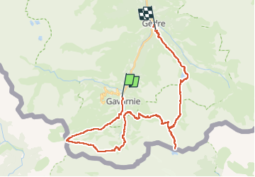
Trail Walking of 41 km to be discovered at Occitania, Hautespyrenees, Gavarnie-Gèdre. This trail is proposed by Franpey.
Positioning
Country:
France
Region :
Occitania
Department/Province :
Hautespyrenees
Municipality :
Gavarnie-Gèdre
Location:
Gavarnie
Start:(Dec)
Start:(UTM)
744740 ; 4735751 (30T) N.
Comments