


les crêtes du coudon norbert

bernir
User
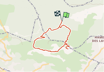

Length
8 km

Max alt
683 m

Uphill gradient
362 m
Km-Effort
12.8 km

Min alt
352 m

Downhill gradient
367 m
Boucle
Yes
Creation date :
2025-02-06 08:38:13.395
Updated on :
2025-03-21 08:58:24.092
6h00
Difficulty : Difficult

FREE GPS app for hiking
 SityTrail
IGN / Geographical institutes
SityTrail Plus
The world is yours!
About
Trail Walking of 8 km to be discovered at Provence-Alpes-Côte d'Azur, Var, Solliès-Ville. This trail is proposed by bernir.
Positioning
Country:
France
Region :
Provence-Alpes-Côte d'Azur
Department/Province :
Var
Municipality :
Solliès-Ville
Location:
Unknown
Start:(Dec)
Start:(UTM)
256470 ; 4784362 (32T) N.
Comments