


segus duroi G3

LouisROGER
User GUIDE
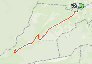

Length
10.5 km

Max alt
1218 m

Uphill gradient
500 m
Km-Effort
17.2 km

Min alt
721 m

Downhill gradient
499 m
Boucle
Yes
Creation date :
2025-02-07 08:16:58.877
Updated on :
2025-02-07 13:25:44.039
5h08
Difficulty : Difficult

FREE GPS app for hiking
 SityTrail
IGN / Geographical institutes
SityTrail Plus
The world is yours!
About
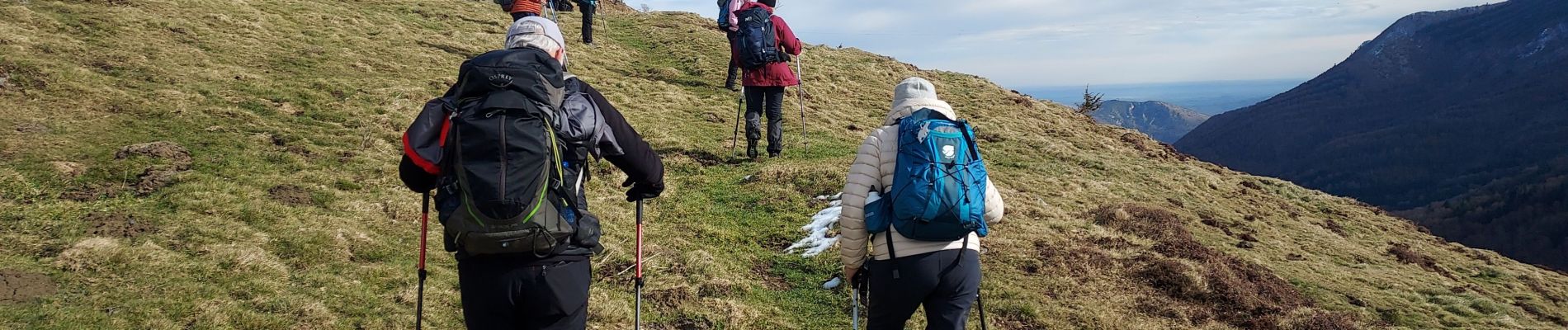
Trail Walking of 10.5 km to be discovered at Occitania, Hautespyrenees, Ségus. This trail is proposed by LouisROGER.
Photos

Positioning
Country:
France
Region :
Occitania
Department/Province :
Hautespyrenees
Municipality :
Ségus
Location:
Unknown
Start:(Dec)
Start:(UTM)
736814 ; 4772593 (30T) N.
Comments