


St pres

topophil
User
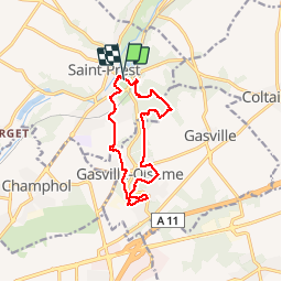

Length
11.2 km

Max alt
154 m

Uphill gradient
149 m
Km-Effort
13.2 km

Min alt
114 m

Downhill gradient
150 m
Boucle
Yes
Creation date :
2015-06-16 00:00:00.0
Updated on :
2015-06-16 00:00:00.0
2h40
Difficulty : Unknown

FREE GPS app for hiking
 SityTrail
IGN / Geographical institutes
SityTrail Plus
The world is yours!
About
Trail Walking of 11.2 km to be discovered at Centre-Loire Valley, Eure-et-Loir, Saint-Prest. This trail is proposed by topophil.
Description
bien
Positioning
Country:
France
Region :
Centre-Loire Valley
Department/Province :
Eure-et-Loir
Municipality :
Saint-Prest
Location:
Unknown
Start:(Dec)
Start:(UTM)
391784 ; 5371866 (31U) N.
Comments
circuit organisée par la marche de maintenon