


Montagne de Land

GOHIER
User
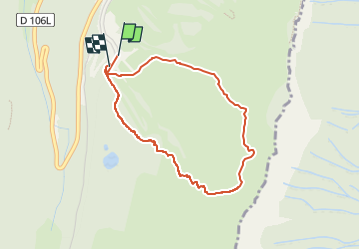

Length
3.8 km

Max alt
1788 m

Uphill gradient
375 m
Km-Effort
8.8 km

Min alt
1406 m

Downhill gradient
380 m
Boucle
Yes
Creation date :
2025-02-07 10:24:19.0
Updated on :
2025-02-08 10:13:04.236
2h34
Difficulty : Easy

FREE GPS app for hiking
 SityTrail
IGN / Geographical institutes
SityTrail Plus
The world is yours!
About
Trail Touring skiing of 3.8 km to be discovered at Auvergne-Rhône-Alpes, Isère, Lans-en-Vercors. This trail is proposed by GOHIER.
Description
Vent de folie mais bien esthétique
Positioning
Country:
France
Region :
Auvergne-Rhône-Alpes
Department/Province :
Isère
Municipality :
Lans-en-Vercors
Location:
Unknown
Start:(Dec)
Start:(UTM)
705234 ; 4998737 (31T) N.
Comments