


Cierp gaud Signac Binos Bachos Guran Burgalay ...

marie-didi
User
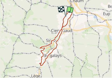

Length
14 km

Max alt
776 m

Uphill gradient
397 m
Km-Effort
19.3 km

Min alt
478 m

Downhill gradient
396 m
Boucle
Yes
Creation date :
2025-02-09 08:23:20.494
Updated on :
2025-02-09 11:01:03.429
2h36
Difficulty : Medium

FREE GPS app for hiking
 SityTrail
IGN / Geographical institutes
SityTrail Plus
The world is yours!
About
Trail Running of 14 km to be discovered at Occitania, Haute-Garonne, Cierp-Gaud. This trail is proposed by marie-didi.
Positioning
Country:
France
Region :
Occitania
Department/Province :
Haute-Garonne
Municipality :
Cierp-Gaud
Location:
Unknown
Start:(Dec)
Start:(UTM)
307679 ; 4755144 (31T) N.
Comments