


Saze reconnaissance. Laurette le 09 02 2025

Loli27
User
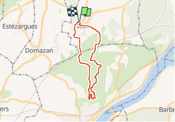

Length
13.6 km

Max alt
166 m

Uphill gradient
262 m
Km-Effort
17.1 km

Min alt
60 m

Downhill gradient
262 m
Boucle
Yes
Creation date :
2025-02-09 08:32:34.488
Updated on :
2025-02-09 16:33:42.735
4h28
Difficulty : Medium

FREE GPS app for hiking
 SityTrail
IGN / Geographical institutes
SityTrail Plus
The world is yours!
About
Trail Walking of 13.6 km to be discovered at Occitania, Gard, Saze. This trail is proposed by Loli27.
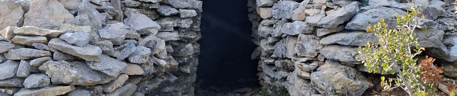
Photos


Positioning
Country:
France
Region :
Occitania
Department/Province :
Gard
Municipality :
Saze
Location:
Unknown
Start:(Dec)
Start:(UTM)
634784 ; 4866867 (31T) N.
Comments