


Le Tanneron - petite boucle

frizou83
User
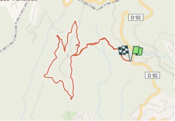

Length
5.8 km

Max alt
399 m

Uphill gradient
202 m
Km-Effort
8.5 km

Min alt
248 m

Downhill gradient
201 m
Boucle
Yes
Creation date :
2025-02-10 13:45:01.396
Updated on :
2025-02-10 13:45:31.378
1h55
Difficulty : Medium

FREE GPS app for hiking
 SityTrail
IGN / Geographical institutes
SityTrail Plus
The world is yours!
About
Trail Walking of 5.8 km to be discovered at Provence-Alpes-Côte d'Azur, Maritime Alps, Mandelieu-la-Napoule. This trail is proposed by frizou83.
Positioning
Country:
France
Region :
Provence-Alpes-Côte d'Azur
Department/Province :
Maritime Alps
Municipality :
Mandelieu-la-Napoule
Location:
Unknown
Start:(Dec)
Start:(UTM)
331871 ; 4824556 (32T) N.
Comments