


Sagne Longur

orsel
User GUIDE

Length
13.9 km

Max alt
3007 m

Uphill gradient
979 m
Km-Effort
27 km

Min alt
2025 m

Downhill gradient
979 m
Boucle
Yes
Creation date :
2025-02-12 08:16:42.26
Updated on :
2025-02-12 13:31:30.317
5h13
Difficulty : Medium

FREE GPS app for hiking
 SityTrail
IGN / Geographical institutes
SityTrail Plus
The world is yours!
About
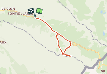
Trail Mountain bike of 13.9 km to be discovered at Provence-Alpes-Côte d'Azur, Hautes-Alpes, Molines-en-Queyras. This trail is proposed by orsel.
Positioning
Country:
France
Region :
Provence-Alpes-Côte d'Azur
Department/Province :
Hautes-Alpes
Municipality :
Molines-en-Queyras
Location:
Unknown
Start:(Dec)
Start:(UTM)
333996 ; 4953884 (32T) N.
Comments