


2025-02-12 Vongnes-Lac de Chavoley

patpounet73
User
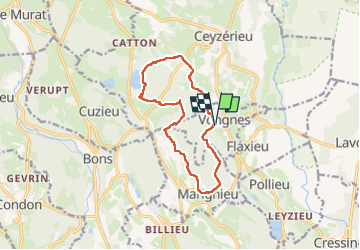

Length
12.3 km

Max alt
438 m

Uphill gradient
315 m
Km-Effort
16.5 km

Min alt
328 m

Downhill gradient
317 m
Boucle
Yes
Creation date :
2025-02-12 08:59:25.324
Updated on :
2025-02-12 17:48:49.025
3h27
Difficulty : Easy

FREE GPS app for hiking
 SityTrail
IGN / Geographical institutes
SityTrail Plus
The world is yours!
About
Trail Walking of 12.3 km to be discovered at Auvergne-Rhône-Alpes, Ain, Vongnes. This trail is proposed by patpounet73.
Positioning
Country:
France
Region :
Auvergne-Rhône-Alpes
Department/Province :
Ain
Municipality :
Vongnes
Location:
Unknown
Start:(Dec)
Start:(UTM)
711588 ; 5076952 (31T) N.
Comments