


Anthisnes crepse (aviation) 18-02-2025

raymondvanroosbroeck
User

Length
16.2 km

Max alt
294 m

Uphill gradient
500 m
Km-Effort
22 km

Min alt
98 m

Downhill gradient
304 m
Boucle
No
Creation date :
2025-02-14 09:57:31.457
Updated on :
2025-02-17 09:34:09.106
5h02
Difficulty : Very difficult

FREE GPS app for hiking
 SityTrail
IGN / Geographical institutes
SityTrail Plus
The world is yours!
About
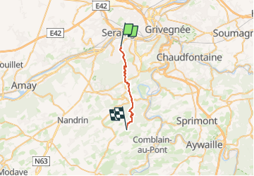
Trail Walking of 16.2 km to be discovered at Wallonia, Liège, Seraing. This trail is proposed by raymondvanroosbroeck.
Positioning
Country:
Belgium
Region :
Wallonia
Department/Province :
Liège
Municipality :
Seraing
Location:
Unknown
Start:(Dec)
Start:(UTM)
677942 ; 5608167 (31U) N.
Comments