


GR 129 - Parcours principal - Modifié temporairement - 2024-08-12

collignpn
User GUIDE

Length
455 km

Max alt
461 m

Uphill gradient
8360 m
Km-Effort
565 km

Min alt
27 m

Downhill gradient
8028 m
Boucle
No
Creation date :
2025-02-14 10:14:19.0
Updated on :
2025-02-21 08:52:33.888
128h30
Difficulty : Very difficult

FREE GPS app for hiking
 SityTrail
IGN / Geographical institutes
SityTrail Plus
The world is yours!
About
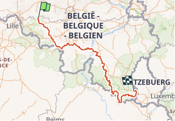
Trail On foot of 455 km to be discovered at Flanders, East Flanders, Ronse. This trail is proposed by collignpn.
Description
La Belgique en diagonale
Positioning
Country:
Belgium
Region :
Flanders
Department/Province :
East Flanders
Municipality :
Ronse
Location:
Unknown
Start:(Dec)
Start:(UTM)
546317 ; 5622730 (31U) N.
Comments