


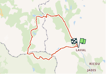
départ parking ref de laval ; tour des cerces

gerardmicheline
User

Length
17.5 km

Max alt
2765 m

Uphill gradient
1035 m
Km-Effort
31 km

Min alt
2021 m

Downhill gradient
1034 m
Boucle
Yes
Creation date :
2025-02-14 14:42:47.653
Updated on :
2025-02-14 14:43:40.962
7h07
Difficulty : Very difficult

FREE GPS app for hiking
 SityTrail
IGN / Geographical institutes
SityTrail Plus
The world is yours!
About
Trail Walking of 17.5 km to be discovered at Provence-Alpes-Côte d'Azur, Hautes-Alpes, Névache. This trail is proposed by gerardmicheline.
Positioning
Country:
France
Region :
Provence-Alpes-Côte d'Azur
Department/Province :
Hautes-Alpes
Municipality :
Névache
Location:
Unknown
Start:(Dec)
Start:(UTM)
305188 ; 4992518 (32T) N.
Comments