


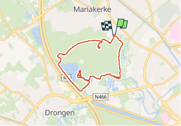
Bourgoyen - Ossemeersen

ppigeon
User

Length
8 km

Max alt
17 m

Uphill gradient
64 m
Km-Effort
8.9 km

Min alt
-8 m

Downhill gradient
64 m
Boucle
Yes
Creation date :
2025-02-16 08:09:25.372
Updated on :
2025-02-16 12:44:10.033
4h31
Difficulty : Very easy

FREE GPS app for hiking
 SityTrail
IGN / Geographical institutes
SityTrail Plus
The world is yours!
About
Trail Walking of 8 km to be discovered at Flanders, East Flanders, Ghent. This trail is proposed by ppigeon.
Positioning
Country:
Belgium
Region :
Flanders
Department/Province :
East Flanders
Municipality :
Ghent
Location:
Ghent
Start:(Dec)
Start:(UTM)
547856 ; 5657507 (31U) N.
Comments