


la gaillarde

vincente204
User

Length
11.3 km

Max alt
237 m

Uphill gradient
339 m
Km-Effort
15.8 km

Min alt
8 m

Downhill gradient
339 m
Boucle
Yes
Creation date :
2025-02-18 08:38:11.263
Updated on :
2025-02-18 14:08:07.443
5h28
Difficulty : Difficult

FREE GPS app for hiking
 SityTrail
IGN / Geographical institutes
SityTrail Plus
The world is yours!
About
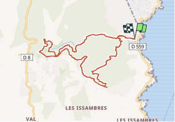
Trail Walking of 11.3 km to be discovered at Provence-Alpes-Côte d'Azur, Var, Roquebrune-sur-Argens. This trail is proposed by vincente204.
Description
facile
Positioning
Country:
France
Region :
Provence-Alpes-Côte d'Azur
Department/Province :
Var
Municipality :
Roquebrune-sur-Argens
Location:
Unknown
Start:(Dec)
Start:(UTM)
314590 ; 4804202 (32T) N.
Comments