


Gert en boucle depuis Troubat

Z'ABC
User

Length
8.2 km

Max alt
1045 m

Uphill gradient
469 m
Km-Effort
14.5 km

Min alt
603 m

Downhill gradient
469 m
Boucle
Yes
Creation date :
2025-02-19 12:59:05.115
Updated on :
2025-02-19 16:23:08.23
3h23
Difficulty : Medium

FREE GPS app for hiking
 SityTrail
IGN / Geographical institutes
SityTrail Plus
The world is yours!
About
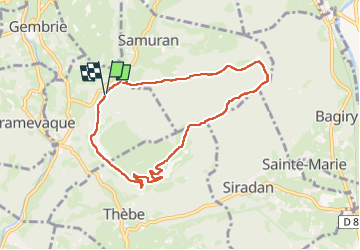
Trail Walking of 8.2 km to be discovered at Occitania, Hautespyrenees, Troubat. This trail is proposed by Z'ABC .
Positioning
Country:
France
Region :
Occitania
Department/Province :
Hautespyrenees
Municipality :
Troubat
Location:
Unknown
Start:(Dec)
Start:(UTM)
303270 ; 4761521 (31T) N.
Comments