


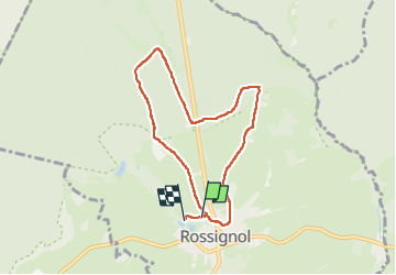
Rossignol

mthseeuws
User

Length
6.6 km

Max alt
402 m

Uphill gradient
100 m
Km-Effort
7.9 km

Min alt
337 m

Downhill gradient
97 m
Boucle
Yes
Creation date :
2025-02-20 09:07:07.564
Updated on :
2025-02-20 11:07:32.844
1h59
Difficulty : Medium

FREE GPS app for hiking
 SityTrail
IGN / Geographical institutes
SityTrail Plus
The world is yours!
About
Trail Walking of 6.6 km to be discovered at Wallonia, Luxembourg, Tintigny. This trail is proposed by mthseeuws.
Positioning
Country:
Belgium
Region :
Wallonia
Department/Province :
Luxembourg
Municipality :
Tintigny
Location:
Rossignol
Start:(Dec)
Start:(UTM)
678974 ; 5510539 (31U) N.
Comments