


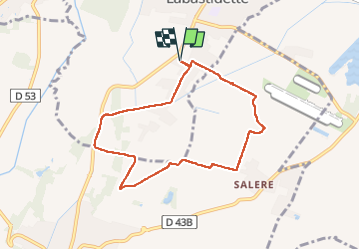
Labastidette fait 2025

pidjam
User

Length
7.7 km

Max alt
223 m

Uphill gradient
56 m
Km-Effort
8.5 km

Min alt
187 m

Downhill gradient
56 m
Boucle
Yes
Creation date :
2025-02-20 13:04:54.332
Updated on :
2025-02-20 15:08:58.286
1h44
Difficulty : Easy

FREE GPS app for hiking
 SityTrail
IGN / Geographical institutes
SityTrail Plus
The world is yours!
About
Trail Walking of 7.7 km to be discovered at Occitania, Haute-Garonne, Labastidette. This trail is proposed by pidjam.
Positioning
Country:
France
Region :
Occitania
Department/Province :
Haute-Garonne
Municipality :
Labastidette
Location:
Unknown
Start:(Dec)
Start:(UTM)
357808 ; 4812815 (31T) N.
Comments