


Reco La Sure

lionelnottat
User
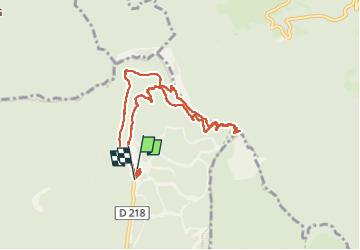

Length
8.5 km

Max alt
1641 m

Uphill gradient
498 m
Km-Effort
15.2 km

Min alt
1295 m

Downhill gradient
508 m
Boucle
Yes
Creation date :
2025-02-20 10:12:40.803
Updated on :
2025-02-20 16:28:13.41
2h44
Difficulty : Difficult

FREE GPS app for hiking
 SityTrail
IGN / Geographical institutes
SityTrail Plus
The world is yours!
About
Trail Snowshoes of 8.5 km to be discovered at Auvergne-Rhône-Alpes, Isère, Autrans-Méaudre en Vercors. This trail is proposed by lionelnottat.
Positioning
Country:
France
Region :
Auvergne-Rhône-Alpes
Department/Province :
Isère
Municipality :
Autrans-Méaudre en Vercors
Location:
Autrans
Start:(Dec)
Start:(UTM)
702624 ; 5011746 (31T) N.
Comments