


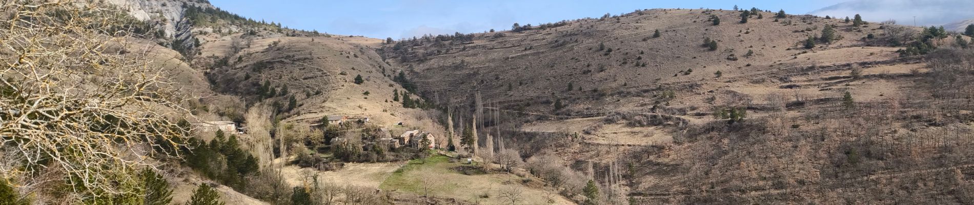
Salanson /Rocher de la Table /Montmirat

tyntyn
User
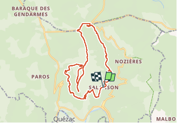

Length
19.1 km

Max alt
1119 m

Uphill gradient
650 m
Km-Effort
28 km

Min alt
640 m

Downhill gradient
653 m
Boucle
Yes
Creation date :
2025-02-20 09:30:59.964
Updated on :
2025-02-20 18:28:08.062
6h18
Difficulty : Very difficult

FREE GPS app for hiking
 SityTrail
IGN / Geographical institutes
SityTrail Plus
The world is yours!
About
Trail Walking of 19.1 km to be discovered at Occitania, Lozère, Ispagnac. This trail is proposed by tyntyn.
Photos


Positioning
Country:
France
Region :
Occitania
Department/Province :
Lozère
Municipality :
Ispagnac
Location:
Unknown
Start:(Dec)
Start:(UTM)
543979 ; 4914976 (31T) N.
Comments