


Moulin sous touvent

pascha
User

Length
13.4 km

Max alt
153 m

Uphill gradient
165 m
Km-Effort
15.6 km

Min alt
85 m

Downhill gradient
162 m
Boucle
Yes
Creation date :
2015-06-21 00:00:00.0
Updated on :
2015-06-21 00:00:00.0
3h27
Difficulty : Unknown

FREE GPS app for hiking
 SityTrail
IGN / Geographical institutes
SityTrail Plus
The world is yours!
About
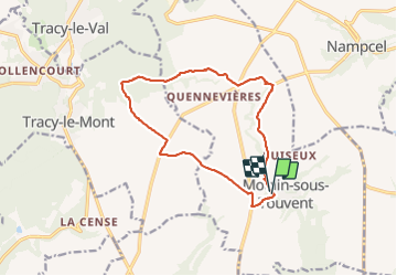
Trail Walking of 13.4 km to be discovered at Hauts-de-France, Oise, Moulin-sous-Touvent. This trail is proposed by pascha.
Positioning
Country:
France
Region :
Hauts-de-France
Department/Province :
Oise
Municipality :
Moulin-sous-Touvent
Location:
Unknown
Start:(Dec)
Start:(UTM)
505201 ; 5478102 (31U) N.
Comments