


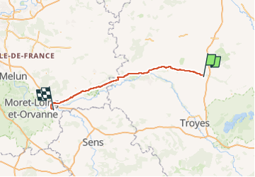
Etape2MONTEREAU-FAULT-YONNE

Le grand Claude
User

Length
106 km

Max alt
91 m

Uphill gradient
547 m
Km-Effort
114 km

Min alt
44 m

Downhill gradient
585 m
Boucle
No
Creation date :
2025-02-24 21:09:42.537
Updated on :
2025-07-07 19:18:38.304
--
Difficulty : Very difficult

FREE GPS app for hiking
 SityTrail
IGN / Geographical institutes
SityTrail Plus
The world is yours!
About
Trail Bicycle tourism of 106 km to be discovered at Grand Est, Aube, Arcis-sur-Aube. This trail is proposed by Le grand Claude.
Description
Longueur 103km
D :532m
Positioning
Country:
France
Region :
Grand Est
Department/Province :
Aube
Municipality :
Arcis-sur-Aube
Location:
Unknown
Start:(Dec)
Start:(UTM)
584072 ; 5376674 (31U) N.
Comments